Imagine you’re on your way to a concert with friends, only to find yourself stuck in a sea of cars, running late for the show. Or maybe the train in your town always creates traffic, and your boss is getting impatient with you turning up late to work. Or picture the areas in your city that you refuse to go to because there are always too many cars and it’s impossible to get around.
These are familiar scenarios for many of us, and the bottom line is, traffic rarely makes our lives better. In fact, studies have found that commuting is often the worst part of someone’s day. If your commute is between half an hour to 90 minutes, it can have a big impact on your happiness and increases anxiety.
Cities that position themselves as leaders of mobility, and tackle their traffic flow problems head-on will increase the overall happiness of their citizens. Not only that, they’ll also make meaningful strides towards sustainability goals.
Picture an open road each time you leave the driveway
Urban mobility is constantly evolving. For example, before 2020 there may not have been e-scooters or e-bikes to rent throughout your city. Now, you may have a hard time finding a major city that doesn’t have this type of transportation.
Personal vehicles, public buses, bicycles, scooters, e-commerce vehicles and private rideshare vehicles all shape our urban landscapes. With this array of mobility choices, the public expects effortless movement when it comes to reaching a destination.
In order to travel somewhere, people want to know that:
- They can get into the city
- They will be able to afford the cost of travel
- They will be able to park
- There will be working and available EV charging stations
- There will be additional transportation available (bike, bus, tram, etc)
- There will be a seamless way to pay for public transportation
- They will be able to use their concessions
That’s a challenging list to fulfil. But by tracking traffic data and combining it with other solutions, like public transportation and parking, your city can make meaningful progress here.
Picture being able to connect with drivers to let them know a neighbourhood is almost at max capacity for parking, or is experiencing an influx in traffic. They can then opt for public transportation, or make new plans without fighting the gridlock. This leads to less drivers on the road, less emissions from stopped vehicles and higher ridership on public transportation.
We spend too much time in traffic – and it’s preventable
From a city leader’s perspective, it’s essential to tackle traffic problems because traffic plays a major role in a city’s perception, and the city’s carbon footprint. In the top 30 cities with the worst traffic congestion, drivers lost anywhere from 156 to 83 hours per driver, per year.
Yet, traffic is a compounded problem, impacted by everything from parking to crashes. And, the complexity of managing various elements of urban transport can be overwhelming.
Many cities have decided to outsource most of their parking which provides some short-term benefits but is ultimately a long-term headache. Some cities have as many as eight parking mobile application providers, leaving travellers without a 360 degree view, and cities unable to adjust costs quickly, and strategically.
Addressing parking to minimise traffic congestion is a source of dissatisfaction for almost all drivers. Frustrations arise due to incommodious payment methods and the inability to find a place to park. And these drivers caught in traffic aren’t just unhappy, they’re also increasing the emissions in your city’s air, and amplifying pollution.
Currently, cities aren’t able to communicate with drivers swiftly enough to reduce congestion. Since parking and public transportation aren’t usually fully connected, cities aren’t able to alert and incentivise low emission travel.
With the right data to hand, you can minimise bumper-to-bumper time for your travellers
A bike requires all of its pieces to move someone from one place to the next. If the chain, tires, brakes, handlebars, or pedals are missing, it can be difficult to impossible to ride it. Think of the way people move throughout your city as pieces of a bike. Let’s say traffic is the chain, public transportation is the tires, and parking is the breaks.
If there are too many single occupancy vehicles, traffic builds up and the bike chain gets clogged, or comes loose. This impacts the wheels, because they can’t move as quickly. Bus routes, e-scooters, and e-bikes are all impacted by traffic. The brakes aren’t being used at all because drivers are at an involuntary stop.
A joined up solution is needed to keep everything oiled and moving. And the foundation of that solution is data. When you can look at the state of the roads, zones and the behaviours of drivers and passengers, you get a holistic view of how people in your city move. Ideally, you also need to be able to see your city in real time so you can make adjustments to rates and strategise long-term improvements.
Flowbird HUB is an effortless way to keep everything moving as it should, often better than before. It provides cities with joined observability for strategic decisions so they can make adjustments and fixes as problems and opportunities arise.
Some of the features that positively impact cities include:
- Applying congestion charges for access
- Applying charges based on type of car (EV vs. a high emissions vehicle)
- Providing drivers with real-time information on traffic and parking availability
- Providing effortless transit payments for public transportation
- Connecting with existing and future equipment
A solution like this enables cities to carve out clean air zones, incentivise low-emissions travel and reach their sustainability goals. It’s diverse enough to work for any city, and helps communities tackle traffic congestion and air pollution.
To learn more, see how Como, Italy used Flowbird HUB to improve the lives of its locals and visitors by taking a 360 degree view of its urban mobility.

 International
  Downtown West Chester Updates Its Parking System with Modern Payment Solutions
  Flowbird Garage Success Leads to On-Street Parking Expansion in Beverly Hills
  The City of Leavenworth Updates Its Parking System with Effortless Parking Solutions
  Nouméa Modernizes Its Parking System with the Installation of New Flowbird Parking Meters
  SEPTA Partners with Flowbird to Launch Advanced Commuter Parking System
  Flowbird ticketing technology alights at Belfast Grand Central Station
  Dallas Area Rapid Transit (DART) Partners with Flowbird to Modernize Transit System
  Flowbird Group Secures 10-Year Contract to Revolutionize Warsaw’s Parking Infrastructure
  Rochester Updates Its Parking System with 3 New User-Friendly Solutions
  Pittsburgh Regional Transit Partners with Flowbird for Fare Payment Solution
  Flowbird Successfully Delivers Advanced Parking Solutions to City of Poznań Road Department
  Parking terminals reimagined – a smart way to reinvent on-street parking technology
  Flowbird Systems Go Live in Madeira
  The next poster cities for mobility
  What politicians and policy makers need to know about MaaS
  MaaS start small and scale up
  Flowbird Pay-by-Plate Pay Stations Launch in the City of New York
  Lyon chooses Flowbird for the implementation of its new progressive parking policy
  Is MaaS an essential foundation for liveable cities?
  Wyre Forest District Council car parks to have electric vehicle (EV) chargers installed
  Flowbird Supplies 500 Pay and Display Parking Meters in Bratislava!
  MaaS: What cities need to do to make it work
  Charleston, SC Updates Its Parking System with Effortless Digital Solutions
  Clearwater, Florida Launches Pay by Text Solution – No App or Account Required
  Carlisle, PA To Update Its Parking System with User-Friendly Solution in 2024
  Open Payments Launched In Toulouse – Contactless Card Validation!
  Flowbird and Semitan join forces to make mobility effortless!
  Meet the Team: David Thompson
  Solving traffic flow – what politicians and policymakers need to know
  The future of the roadside curb
  The future of the passenger experience and why effortlessness is the key
  A guide to your city’s passengers: What you need to know
  The 4 roadblocks in your city’s e-mobility plan
  The road to zero-emissions cities (and, the parking when we get there)
  Why wait to decarbonise our regions?
  Flowbird Group takes a step forward in reshaping mobility through a strategic acquisition by EasyPark Group
  Park&Charge: Meet our expert
  Flowbird gives cities a fast-track to e-mobility readiness
  Coming soon to Perth: ‘tap to ride’ with your bank card or device
  What’s next after open-loop transit payments?
  What would motivate you to use your car less?
  How to Boost the Efficiency of Fare Collection
  Lothian Buses new record: 100,000 taps in a day!
  Smart Transport Ticketing: Benefits for Operators and Passengers
 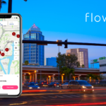 Flowbird App Empowers Tampa’s Parking Experience with Multi-App Integration
  Meet the team: Justin Pounder
  Flowbird, Umojo Partner for Off-Street Solution in Portand
  Cash versus digital payments in mobility systems
  Flowbird teams up with Zuora to advance digitalisation and growth
  Flowbird app & Pay by Text now available in Sewickley!
  FabMob and Flowbird lead the way for accessible, sustainable mobility
  Passenger apps: Take 5 operator benefits
  Contactless Interac Debit fare payments launch on Laval buses
  Edinburgh tramline extended to provide a route across the city
  Take 5… Transport authority benefits of Account Based Ticketing
  Parkex | Birmingham | 2023
  Flowbird Partners with the City of Minneapolis to Launch New & Improved MPLS Parking App
  Flowbird presents its vision for connected urban mobility at AMWE in Paris
  Clermont Ferrand makes the move to open payments on transport
  Flowbird’s transport talking points at Transport Ticketing Global
  Take 5… Operator benefits of open payments in transport
  Flowbird envisions the transport ticket of tomorrow
  Ticketing & payments – a vital enabler of National Bus Strategy
  Flowbird announce new additions to the management team further to accelerate growth ambitions within the UK parking sector
  New London Brings Additional Convenience Parkers with Flowbird App
  Podcast: Will transport payments drive a MaaS revolution?
  Take 5… Passenger benefits of open payments on transport
  South Orange Parking Authority Updates Its Parking System with User-Friendly Solution
  New ParkNYC App Proves to be Unrivaled Success in First 30 Days
  Monapass – One App, One Account, for Open Ticket Mobility
  Translink Milestone for National Account Based Ticketing System for Northern Ireland
  Flowbird Announces New CEO
  Flowbird unveils Off-Street Solution at IPMI 2022
  Flowbird is featured in the “Ticketing in Mobility as a Service” handbook published by UITP & STA
  Flowbird Group acquires Your Parking Space
  Transport Ticketing Global | London | 2022
  AIPARK Pdays | Florence | 2022
  Ontario Transportation Expo | Toronto | 2022
 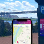 Flowbird Implements Automated Parking System To Palisades Interstate Parks
  Smart City Forum | Warsaw | 2022
  Birmingham Jefferson County Transit Authority Partners with Flowbird
  PARKEX | Birmingham | 2022
  EVS35 | Oslo | 2022
  European Mobility Expo | Paris | 2022
  Konferencja SPP | Grudziądz | 2022
  Svepark Conference | Gävle | 2022
  Milipol Qatar 2022
  Mobility Hubs | London | 2022
  MILIPOL Qatar | Doha | 2022
  A look back at the PACE 2022
  Thank you for visiting us at Intertraffic Amsterdam
 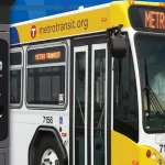 Flowbird Group to Expand Off-Board Fare Payments for Metro Transit
  Intertraffic | Amsterdam | 2022
  Flowbird completes first ever local authority Electric Vehicle charge point project for Wokingham Borough Council
  Podcast: the rise of open payments in transport
  See you soon at Intertraffic Amsterdam 2022!
  Flowbird is excited to share with you the latest news about Hong Kong!
  City of Des Moines upgrades to smart multi-space technology with Flowbird Group
  Flowbird trusted by HKT for their Smart City program
  Flowbird announces a licensing agreement with Concar
  Mobility Awards City Rail & Transport
  A great strategic win in Hamburg
  Lothian Adopts Weekly Capping with Support from Flowbird
  Tisséo, Flowbird and CIC deploy Open Payment in Toulouse
  International Spotlight falls on MaaS in Monaco
  Northern Completes Major UK On-Station Rail Retailing Rollout
  Flowbird Transforms Urban Mobility in Monaco
  Conduent Transportation and Flowbird Selected to Equip Paris Ile-de-France Mobilités’ Buses and Trams with Next-Generation Onboard Ticketing Platform
  Flowbird’s Open Payments Expertise Wins Innovation Award
  STL teams up with Flowbird and other new business partners to deliver a Québec First ― Next-generation credit card payment solution on all Laval buses
  Flowbird Extends Ticketless Parking Across Transperth SmartRider Network
  One million ‘taps’…and counting
  Canberra Launches Smart City Light Rail Network with Flowbird Technology
  Flowbird Releases Mobile Ticketing App – ‘Loop Trolley’ App is Now Live in St. Louis, Missouri
  IndyGo Partners with Flowbird to Modernise Fare Collection System
  Transperth Extends Partnership with Flowbird Transport Intelligence
  World-class ticketing system glides into Belfast
  Edinburgh Trams Taps into Contactless Benefits